
 Yesterday's excursion took me to the Quabbin Reservoir for a short hike. The Quabbin has an interesting history which includes the "discontinuation" of four towns that used to inhabit the valley: Dana, Enfield, Greenwich, and Prescott. You can read a bit about the Quabbin and the Winsor Dam by clicking on the "dcr" picture on the right.
I started off on an information seeking quest -- to find the visitor's center and glean some knowledge -- and maybe even find a map of hiking trails. (The Visitor's Center is off Rt 9 in Belchertown and ajoins the State Police.) The VC has historical books about the Quabbin, lists of animal sighted, statistics about rainfall, and information about the towns the were discontinued. For $2.10 I was able to pick up a hiking trail map of the south end of the Quabbin; there were a few other maps available as well.
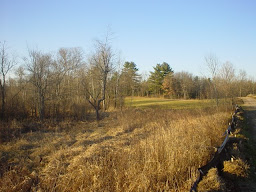
 Soon I left the building and was walking across the Winsor Dam, a beautiful length of grassy road, admiring the water, the blue sky, the trees, and the stony shores. I crossed the dam and headed up a road that led to the Winsor Memorial -- erected for Frank E Winsor who was the chief engineer of the dam.
The Quabbin was built in 1939 and is the largest body of water in Massachusetts, at 39.4 square miles of surface area. It holds 412 billion gallons when filled to capacity and serves as the water source for the metro-Boston area.
However, it's not just the numbers that are extraordinary about this location; the shear beauty alone is breathtaking. Though I didn't make it to the lookout tower, my short hike was pleasant and peaceful, and I'm looking forward to going back soon. The Quabbin is the perfect place to go for hiking, walking, cycling, or running, and it's a wonderful location for birdwatching and other nature-based pursuits -- in fact, a moose had been spotted on Quabbin property earlier that morning, and I had the pleasure (?) of nearly running into a flock of very large turkeys!


No comments:
Post a Comment